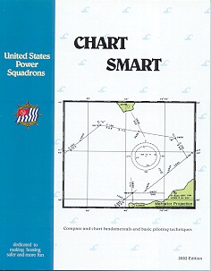
Chart Smart

Note: Chart Smart is no longer available. This web page is for historical purposes only.
Chart Smart was specifically designed with the recreational boater in mind. It was for all USPS boating safety course graduates who were interested in information on compasses, charts, and plotting courses. Chart Smart built upon the knowledge gained in Boat Smart or the original America's Boating Course by covering advanced subjects introduced in the The Squadron Boating Course and the new America's Boating Course - 3rd Edtion:
- Mariner's Compass
- Conventional Nautical Charts
- Plotting a Course
- Distance, Speed, Time
- Determining Position
- Digital Charts and GPS Waypoint Navigation
The purpose of Chart Smart was to teach the techniques to determine position-on-the-water when you are within the sight of, or the near proximity of, land. Thus, recreational boaters who spend time on large lakes, rivers, and reservoirs will benefit from knowing these essential techniques. This seminar was designed to give the student an introduction to the subject known as “Piloting”. Hands-on experience was achieved in reading nautical charts and plotting courses, both central to determining position-on-the-water and navigating safely. Calculating a dead reckoning position depends upon straight forward distance vs speed-&-time calculations and being able to convert true courses to compass courses, and vice versa.
Many of today’s recreational boaters utilize GPS receivers and perform electronic, waypoint navigation. Waypoint navigation using a handheld GPS is somewhat different from traditional dead reckoning. With a GPS you have good information about where you are in terms of latitude and longitude, but the GPS doesn't tell you what is around you or beneath your boat. Using waypoints, you have precise information about the bearing and distance from your current location to the waypoints, but the GPS doesn't know what may be in the way. The use of charts was explained as the essential step to provide key information required for a safe passage. And, the student manual was accompanied by an addendum and a CD that introduced digital charts, GPS waypoint navigation and route planning. Maptech's Chart Navigator Training CD included software and digital charts to gain familiarity with this exciting new technology.
While the content of this student manual served as the basis for this program, it also served as a reference book in basic boating long after the class work was completed. USPS believes that the more educated a boater becomes, the more likely that boater will be a safe boater. Chart Smart was a continuation of boating education, and hopefully encouraged students to join USPS to follow this brief and basic introductory program with additional boating education such as the courses offered to members of the United States Power Squadrons.
Additional USPS Educational Materials are available to the public, including the USPS University series of courses.
 |
|
|

