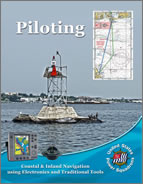
Piloting
This site is provided as a means of communications with the USPS National Inland and Coastal Navigation Committee (ICNCom). We welcome your questions and comments on our modules, Learning Guides, and associated materials.
R/C Eric Pearson, SN
Stf/C Burt H. Pearson III, SN
Stf/C Ken Scherz, SN
Topics
|
|
|
|
|
|
News
Piloting Now UsingOpenCPN
The Piloting course is now using OpenCPN for digital charting and all references to previous digital charting software in the course material should now refer to OpenCPN. The Piloting Student Manuals now include a new Appendix B that provides the information required to change from the Rose Point Coastal Explorer CD to OpenCPN software for the Piloting course. A chart file for Bowditch Bay may be downloaded at BOWDITCH BAY digital chart (290KB, ZIP) or BOWDITCH BAY paper chart (2712KB, PDF). (13 Apr 17)
Errata for Piloting Materials
An updated errata sheet is available for the Piloting Student and Instructor Manuals, as well as the PowerPoint slides. Get the errata sheet from the Downloadable Material section of this page. (11 Jun 14)
On-The-Water Component to the Piloting Course
A very useful lesson plan for an On-the-Water component addition to the Piloting course is now available for download and use by squadron instructors. It is not part of the course exam, but will aid in extending the classroom learning experience. See the download section below. (20 Sep 12)
Updated 2011 Piloting Manual
The updated Piloting Manual (2011 Edition) is now available for ordering. The manual includes four Bowditch Bay charts. This number of charts included was reduced from previous printings because of the increasing cost of printing and including fold out sheets in the manual, and indications that not all were always used. Additional charts can be ordered from the America's Boating Course 3rd Edition section of the on-line catalog. Charts can be erased and used more than once. They also can be reproduced.
The form for exercises 1-1 and 1-2 was inadvertently omitted from this printing of the manual. That form is available in the Downloadable Material. (01 Mar 12)
USCG District 9 Charts for Use in Coastal Explorer Express Program
The previous (February 3, 2010) CD version of Rose Point's Coastal Explorer Express viewer program may have a corrupted zip file for the charts of USCG District 9. If you have a problem loading USCG District 9 charts from your CD, download a good copy of the zip file (254,458KB) and install it in Coastal Explorer. (22 Nov 11)
Two Weekend Navigator Editions In Existence
The Piloting course materials contain numerous references to the Weekend Navigator. Two editions of Weekend Navigator now exist. The recently issued edition has the words “Second Edition” on the cover. The Second Edition contains the chapters in the original, with an additional new chapter 19 on the subject of AIS. This results in the material covered in the original chapters 19 and above now being in chapters numbered one higher—20 and above.
When using present course materials with the Second Edition of Weekend Navigator, take into account the change in chapter numbers. The next revisions of the Piloting manuals will be updated to reflect this change in chapter numbers. (22 Nov 11)
Celestial Tools for Use by Piloting Students
There is a Windows computer tool/program with several applications, some of which are suitable for use by Inland and Coastal Navigation students as well as Offshore Navigations students. See the Downloadable Material section for details. (28 Sep 11)
How to Pass the Final Exam
A short PowerPoint presentation is available on the instructor CD and also under Downloadable Material. It covers many of the most common mistakes made by students that lower their scores on the final exam. We strongly suggest you present it to your class just before you hand out the final exam. (02 Dec 10, updated 01 Mar 12)
2011 Piloting Manual and Piloting Instructor Manual Errata
-
Both Manuals
The standard for labeling speed was revised from “two significant digits” to “tenth of a knot.” This change was omitted in some places in the Instructor Manual and the Piloting Manual. Tenth of a knot should be used for speed throughout the Piloting course and exam (01 Mar 12)
-
Instructor Manual
Page 77: Delete all information on page 77. It is erroneous. (13 Jan 11)
Piloting Course Description
Piloting is the first course in the sequence of USPS courses on navigation, covering the basics of coastal and inland navigation. This course focuses on navigation as it is done on recreational boats today and embraces GPS as a primary navigation tool while covering enough of traditional techniques so the student will be able to find his/her way even if their GPS fails. The course includes many in-class exercises, developing the student’s skills through hands-on practice and learning. Ten classes of two hours each normally are scheduled for presentation of this course. In addition the students have seven days to complete the open book exam. Topics covered include:
- Charts and their interpretation
- Navigation aids and how they point to safe water
- Plotting courses and determining direction and distance
- The mariner’s compass and converting between True and Magnetic
- Use of GPS – typical GPS displays and information they provide, setting up waypoints and routes, staying on a GPS route.
- Pre-planning safe courses and entering them into the GPS
- Monitoring progress and determining position by both GPS and traditional techniques such as bearings and dead reckoning
- The “Seaman’s Eye” – simple skills for checking that one is on course.
Downloadable Material
Bowditch Bay Chart for use with OpenCPN
Download the Bowditch Bay chart (290KB, ZIP-KAP) for use with OpenCPN. (12 Mar 16)
Errata for Piloting Materials
Some errors have been noted in the Piloting Student and Instructor Manuals, as well as the PowerPoint slides. Corrections for these errors are noted in this errata sheet (9KB, PDF). (11 Jun 14)
On-The-Water Component to the Piloting Course
A very useful lesson plan for an On-the-Water component addition to the Piloting course is now available for use by squadron instructors. It is not part of the course exam, but will aid in extending the classroom learning experience. Course instructors can start using it right away to add to the boating fun and share the learning experience with their students. (20 Sep 12)
Form for Piloting Exercises 1-1 and 1-2
Download the form for exercises 1-1 and 1-2 which was inadvertently omitted from this printing of the manual. (01 Mar 12)
USCG District 9 Charts for Use in Coastal Explorer Express Program
The previous (February 3, 2010) CD version of Rose Point's Coastal Explorer Express viewer program may have a corrupted zip file for the charts of USCG District 9. If you have a problem loading District 9 charts from your CD, download a good copy of the zip file (254,458KB) and install it in Coastal Explorer. Note that this is a rather large file and may take some time to download depending on your Internet connection speed. The procedure to download and install the file is as follows:
-
Click on this link to download the zip file, browse to your "C:\Charts" folder/directory, and save the zip file to this folder/directory.
-
Start Coastal Explorer Express.
-
Click on the menu icon to "Access program options, install charts, and configure electronics.", and select "Install Charts..." from the pull-down menu.
-
In the resulting window, click on the "Install charts from a ZIP file..." option.
-
Browse to your "C:\Charts" folder/directory if it doesn't come up automatically.
-
Click on the file you just downloaded, which should be named "09CGD_RNCs.zip", then click "Open" or "OK". You should get a message that the charts are being installed and that it may take a little while to complete.
-
Close the window after the charts are installed. You can then check that the charts are installed by using the Chart Portfolio to see all the charts you have installed. (22 Nov 11)
Celestial Tools Use by Piloting Students
Celestial Tools is a Windows program intended primarily as an aid for sight planning and rough checking of sights for celestial navigation courses. Celestial Tools also incorporates components that will assist in performing DR calculations, 60D=ST, Distance to Horizon, TVMDC, and current calculations. These elements will be helpful to students of Piloting and Advanced Piloting to verify calculations. Get Celestial Tools from the ONCom Tools and Software web page. (28 Sep 11)
How to Pass the Final Exam
This PowerPoint presentation (543KB) covers the most common mistakes made by students on the final exam. It is strongly suggested that you present this to your class immediately before or after handing out the final exam. (02 Dec 10)
Questions or Comments?
If you have any questions or comments about the Piloting course, please contact the National Inland and Coastal Navigation Committee chairman by e-mail, phone or postal service mail. Please be sure to keep your SEO and/or DEO advised of any correspondence you may have with the National committee. Addresses for the National ICNCom chairman are listed in The ENSIGN and on the Committee Chairpersons page.
We will try to answer your questions as soon as possible, but please allow 5 working days for an answer.
 |
|
|


